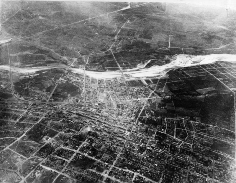
Floating some 9,000 feet above the city in a hot-air balloon in 1887, Edwin H. Husher took what may be the first aerial photo of Los Angeles. (I tell the full story behind this historic image and its creation over at Los Angeles Magazine.)
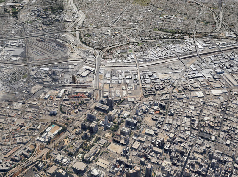
After seeing the photo, The Atlantic‘s Alexis Madrigal had a great idea: why not overlay the aerial image onto a present-day map of the city? My Photoshop skills were not quite up to the task, but I was able to simulate the same view today using Google Earth. Sharp eyes will notice that the perspective is not exactly the same—with altitude, location, and tilt, there were simply too many variables—but it is fun to compare how the city looked in 1887, when roughly 20,000 people called it home, to the metropolis of nearly 4 million people today.
The Los Angeles River suffers the most dramatic change. In the earlier image, the river’s wide, sandy wash dominates the landscape. By 2013, the river has been reduced to a concrete flood channel, fading into the surrounding industrial development.

Leave a reply to Diana Cancel reply